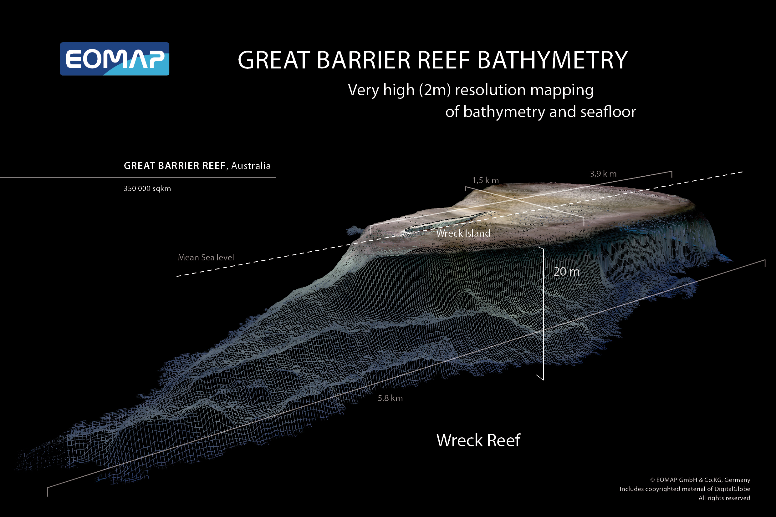
First High-Resolution Map of the Entire Reef from the World's Biggest Satellite-Derived Bathymetry Survey
Welcome to the homepage for the high resolution, satellite-derived bathymetry (SDB) of the entire Great Barrier Reef (GBR). Here you can learn more about the project, download free samples, and order both the flagship 30 m horizontal resolution product. To learn more about the project and the products, including an introduction to SDB, please download further information below.

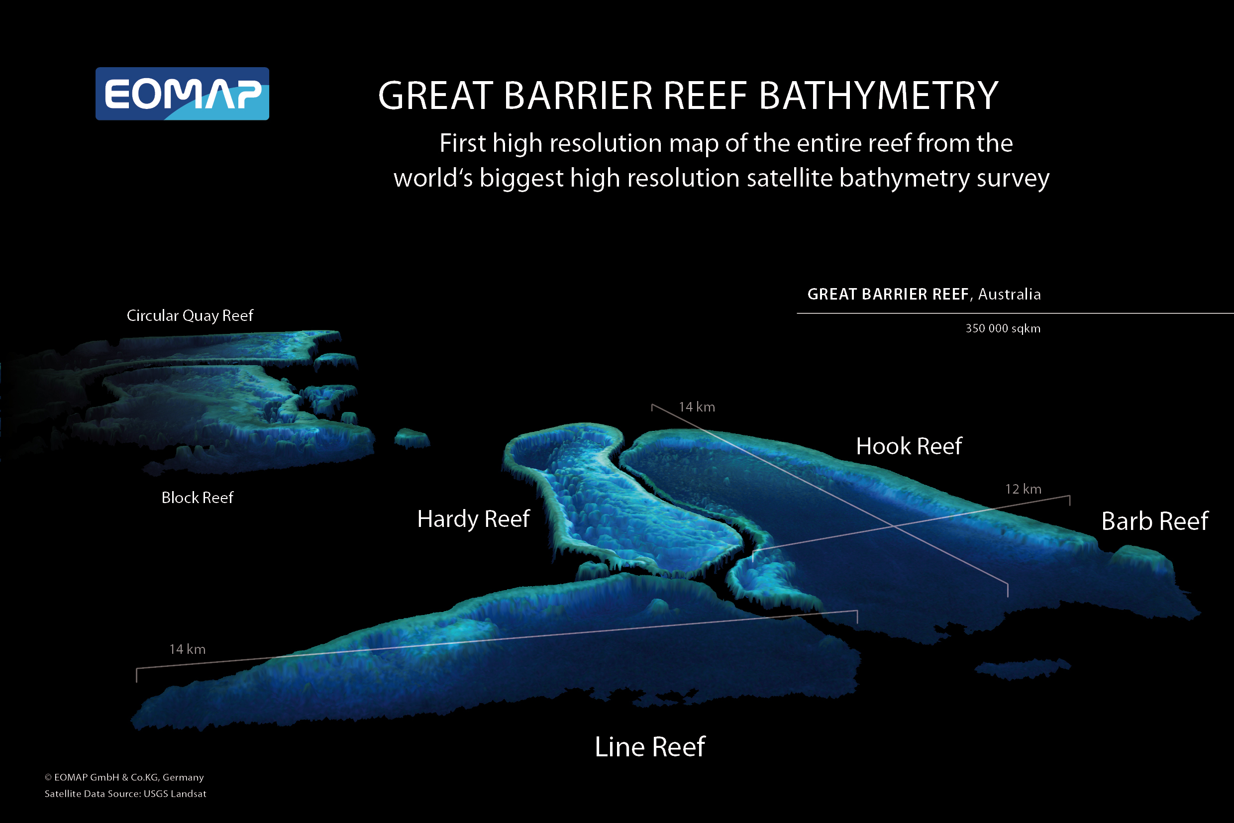

Product Specifications
The two main product types available are:
- digital, shallow water bathymetry maps for any or all parts of the Great Barrier Reef and
- digital, shallow water seafloor reflectance (color and brightness) maps for any or all parts of the Great Barrier Reef.
Please note that all bathymetry products are at a nominal 10 cm vertical resolution. For a more detailed description, as well as independent assessments of these products, please see the project information booklet, downloadable in section “Further documents for reading” on the left.
Sample Data
A 2m very-high resolution sample dataset from Heron Reef is part of our SDB Demo Dataset. You can request the dataset simply by filling out the form below and submit your request. A download link will be provided by e-mail.
Error: Contact form not found.
Please use our contact form to enquire further information about purchasing our products for any or all parts of the Great Barrier Reef.