
Large volumes of unstructured satellite and environmental data, limited budgets and tight deadlines do not always make for wise decisions. We can provide you with appropriate information and reports for your project. Our team of senior experts has provided consultancy services to clients ranging from industry and governmental agencies to international court tribunals.

We provide secure, web-based portals to explore, query, request, visualise and analyse geospatial data. Our online data processing suite eoLytics offers customized in-house solutions for our clients. And EO Store provides clients with rapid access to our extensive archive of satellite derived data products worldwide.


Research, innovation and an eagerness to expand the limits of modern Earth observation and geospatial analysis are in our blood. They are how our company started and to this day we are still investing in research and innovation. Not only does this allow us to improve our services and the quality of our data, but we are actively contributing to the understanding of our world’s environments. We are working with national and international organisations to develop new and interdisciplinary solutions.
An integrated solution: Our Shallow Water Services provide valuable information for coastal engineers and modelers, they ensure profound knowledge for uncharted or outdated areas in hydrographic maps or help to conceive some of the most precious ecosystems of our planet.
Don’t get your feet wet: Access to unpolluted drinking water is a future key challenge, rivers are under increasing pressure caused by sewage discharge and inland navigation and governmental agencies are obliged to assess and report the state of countless lakes. Our harmonized, high-resolution Inland Water Quality Monitoring Services are the key to a better understanding of cause and effect relationships.
Hot-spots of biodiversity: Gathering data on coastal habitats and benthic cover, water pollution or algae blooms is vital for the protection of valuable ecosystems and biocenoses, within the context of coastal infrastructure projects or impacts of climate change. Our habitat mapping services provide detailed insights even into the most remote habitats.
Make use of the third dimension: Hydrodynamic modelling is key to every planning phase of coastal and marine construction and coastal zone management and EOMAP’s solution offers you a gridded, seamless dataset of land and sea elevation information.
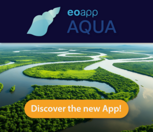
An entire atlas in one URL: EOMAP’s portals are your gateway to benefit from the recent advances in geospatial information, anytime, anywhere using easy to use web apps.
Be your own data provider: We deliver state-of-the art software solutions to customers who wish to perform sophisticated processes in-house. Our solutions help you manage often very complex models and workflows – without having in-depth scientific understanding.
Dr. J. de Lima Rego (ICT and Decision Support Systems Expert, Deltares)
“The bathymetric data fulfilled our needs for the storm surge modelling. Data was delivered in about 24 hours after our order and costs were considerably lower when compared to other survey methods. With this input we were able to improve even more our model predictions.”
J. Siermann (Quatar Shell GTL)
“For this location coverage we estimated to have made a cost saving of approximately one million dollar compared to a traditionally executed bathymetry and/or topographic survey.”
Dr. R. Ressel (Director Geomatics Department of CONABIO/Mexico)
“The services and products delivered for the Mexican Maya coast are exceptional and fundamental in developing our seafloor habitat baseline.”
Daniel Limpitlaw (Kore Potash)
“The EOMAP solution provided us with an inexpensive and fast way of building a baseline to inform the design of the marine components of our project.”
Jayaprakash Athmaram & Ashish GS Srinivasan (Zakum Development Company (ZADCO)
“Very useful tool that can help us acquire reliable bathymetry information in shallow water bodies that are saturated with submerged dangers and hazards to safe navigation.”
Please use the form below to send an order inquiry.
Meet us at upcoming events.
There are no upcoming events at this time.
EOMAP GMBH & CO. KG HEADQUARTERS
Schlosshof 4a
82229 Seefeld, Germany
+49 (0) 8152 9986 110
EOMAP AUSTRALIA PTY LTD.
Level 2, 14-20 Aerodrome Road
Maroochydore, 4558, Queensland, Australia
+61 (07) 5660 6569
Dr. Magnus Wettle
Managing Director EOMAP Australia Pty Ltd.
wettle@eomap.com
EOMAP USA INC.
Santa Barbara
California, USA
+1 (805) 335-0495
+1 (868) 387-0121
Edward Albada
Principal EOMAP USA – N. Americas and Caribbean
edward.albada@eomap.com
EOMAP ME
P.O Box 114169
Dubai, UAE
+971(0) 5865 36627
+971(0) 477 0 477 1
Rahul Sidharth
Director- Business Development & Operations (MENA & India)
rahul@eomap.com